
A river the colour of the sky
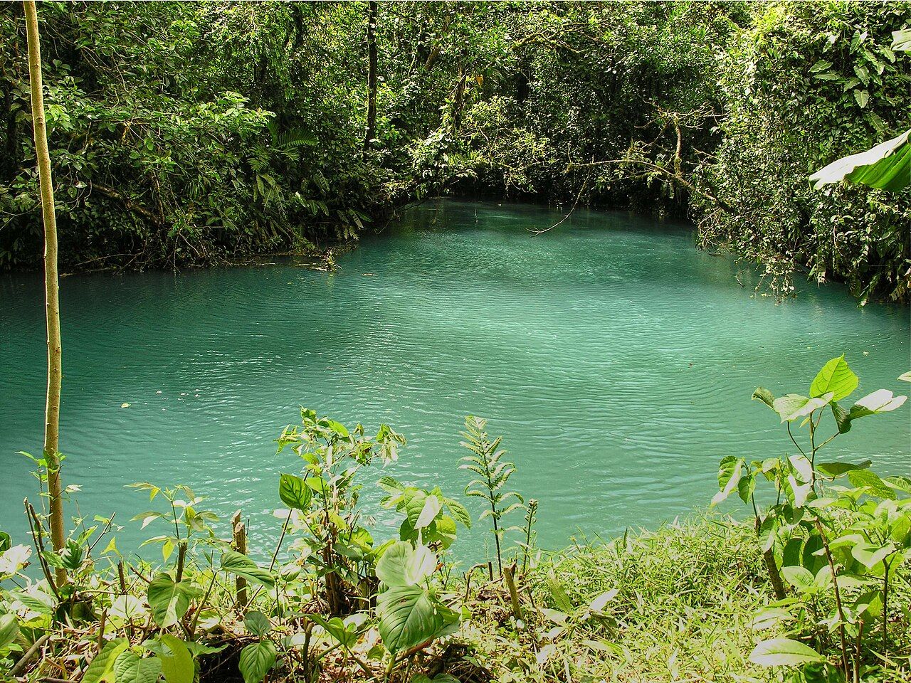
Río Celeste runs through the forest of Tenorio Volcano National Park, in the north of Costa Rica between the Pacific lowlands and the plains toward the Caribbean. On a good day the river is an intense, opaque blue, as if someone had poured paint into it. The waterfall that drops into a blue pool is one of the most photographed sights in the country.
The park protects rainforest and cloud forest on the slopes of Tenorio, a forested volcano whose summit is not open to visitors. Most people come for a single trail that follows the river to the point where its colour begins.
The forest here is lush and wet, catching moisture from the Caribbean side, and it holds the same mix of wildlife as other parks on the northern volcanoes: howler monkeys, toucans, coatis and many kinds of frog. Few visitors stay long enough to look for it, because the river takes all the attention. Walking slowly and stopping between viewpoints gives the forest a chance too.
Why the water turns blue
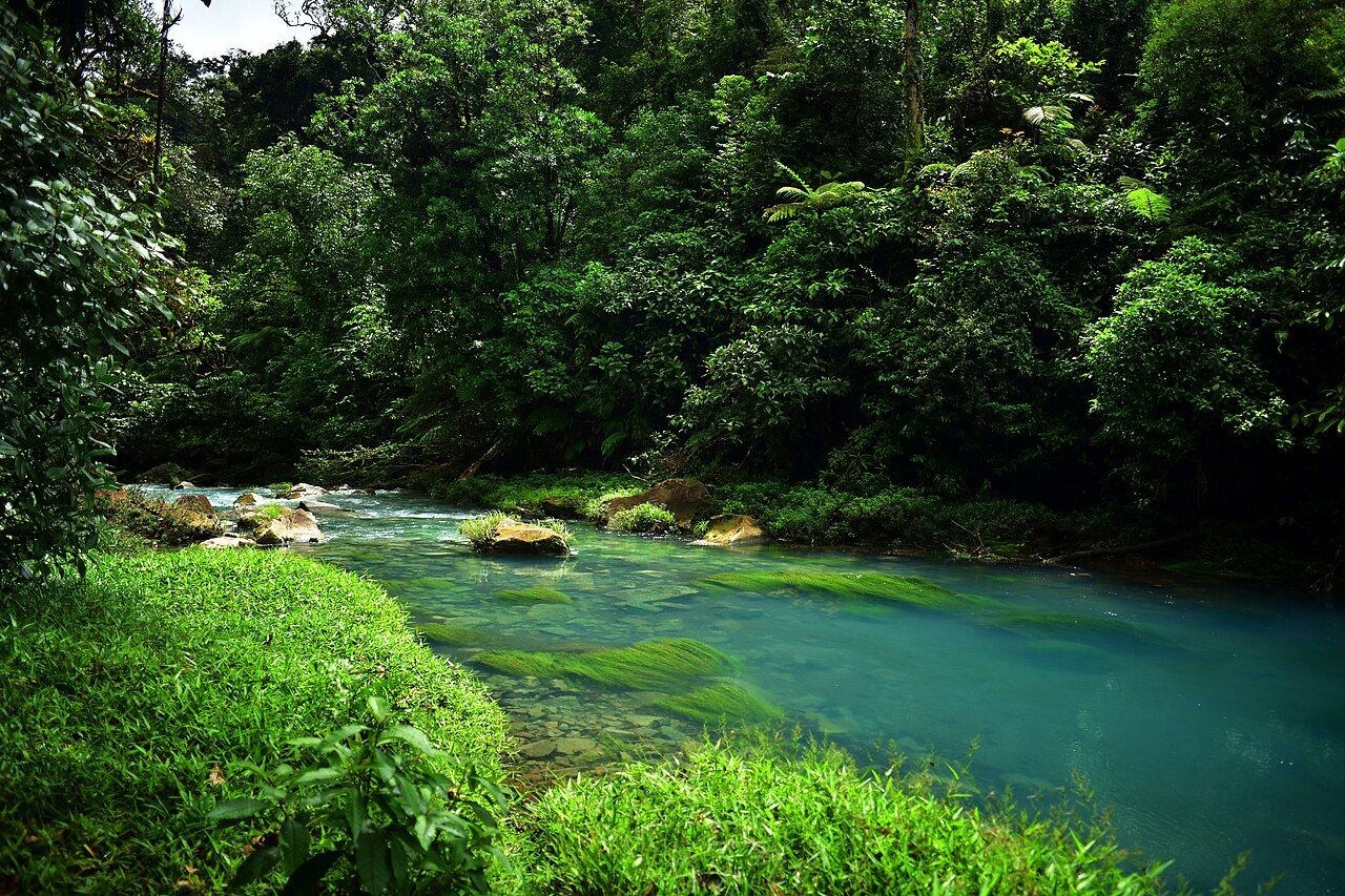
For a long time the colour was explained by dissolved copper or sulphur, but the real cause is light. Upstream, two clear rivers meet at a spot known as Los Teñideros. One carries water that is more acidic and rich in dissolved minerals from the volcanic system. When the two mix, the change in acidity makes tiny mineral particles clump together into larger ones, suspended in the water.
Those particles are just the right size to scatter sunlight, and they scatter blue light most strongly. The water is not dyed blue; it looks blue because of how the particles bounce light back to your eyes, much as the sky looks blue because of how air scatters sunlight. In shallow water near the edges, the colour fades, and the riverbed rocks take on a pale, whitish coating from the same minerals. Above the meeting point, both streams are clear. Below it, the river glows.
The effect depends on the water. After heavy rain, extra sediment washes in and the river turns milky or grey. After several dry days, the blue is usually at its best, and morning light under clear skies shows it most strongly.
The waterfall trail
The main trail starts at the park's ranger station on the Bijagua side of the park and runs a few kilometres each way through the forest, with several stops along the river. It is an out-and-back walk, so you return the way you came, and the order of the stops below follows the trail from the entrance.
- The waterfall: reached by a long staircase that drops steeply to a viewpoint above the blue pool. The climb back up is the hardest part of the day.
- The lookout and the blue lagoon: viewpoints over the forest and over a still, blue pool in the river.
- Los Borbollones: a stretch where volcanic gas bubbles up through the riverbed, with a faint smell of sulphur.
- Los Teñideros: the meeting point of the two streams, where clear water turns blue before your eyes.
Allow around three to four hours for the full walk at an easy pace, more if you stop often. The park sets daily visitor limits and a last entry time in the early afternoon; hours and fees change.
Mud, stairs and footwear
This is one of the wettest corners of the region, and the trail is muddy for much of the year, sometimes deeply so. Wooden boardwalks and steps cover part of it, but expect sections of slippery clay and roots.
- Wear waterproof boots or rubber boots with good tread; sandals and city trainers are a poor choice.
- Take the waterfall stairs slowly, hold the rail, and give way to people climbing up.
- Carry water and a snack; there are no shops along the trail.
- Pack a rain jacket even if the morning is clear.
- Keep dry socks and a change of clothes in the car.
Snakes live in the forest, so watch where you step and do not put your hands on branches without looking. Tapirs and other wildlife move through the park as well; keep your distance and never feed anything.
Swimming is not allowed
Swimming is not permitted anywhere in the river inside the park, including at the waterfall pool and the blue lagoon. The rule protects the river, the banks and visitors: currents near the falls are strong, rocks are slippery, and the water around the volcanic springs can be acidic and hot in places.
Please respect it. Rangers patrol the trail, and the rule exists because people kept climbing down to the water and damaging the banks. Some private land outside the park has pools on the same river where bathing is allowed.
Getting there and the wider area
The village of Bijagua, on the road between Upala and the Inter-American Highway, is the nearest base. From there a road, rough in places, leads to the park entrance. The drive from San José takes around four hours, and from Liberia or the Arenal area it can be done as a day trip. A high-clearance vehicle helps after rain; read up on driving and buses before you go.
The area sits between Tenorio and Miravalles volcanoes, and you can combine a visit with time near Arenal Volcano and the lake or the mud pots of Rincón de la Vieja. Early starts pay off everywhere here: clearer skies, cooler air and quieter trails before the midday cloud builds over the mountains.